Last Updated: August 5, 2026
South Dakota is one of the best states in the middle of the country for vehicle-based travel, and it is also one of the easiest to get wrong. Half the “top overlanding trails in South Dakota” lists floating around the internet send you to places where driving is flatly illegal, and a couple of them will get you a citation if you follow them. We know, because an earlier version of this guide made that same mistake, and we have rewritten it from the ground up against Forest Service and Park Service sources.
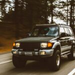
Here is the short version. The Black Hills National Forest has more than 3,800 miles of roads and trails open to motorized travel, but the majority of the designated OHV trail mileage is restricted to vehicles 62 inches wide or less, which rules out nearly every full-size overlanding rig. If you are driving a Tacoma, a 4Runner, a Bronco, or anything wider, your South Dakota routes are the forest roads, the roads marked “open to all vehicles,” the Camp 5 area 4×4 trails, and the gravel roads through Badlands country. That is still hundreds of miles of good travel, and it is more than enough for a long weekend or a week.
Quick reference
| Route | Where | Difficulty | Rig fit | Best season |
|---|---|---|---|---|
| Sage Creek Rim Road (SD 590) | Badlands NP | Easy, graded gravel | Any vehicle when dry | Spring through fall |
| Buffalo Gap forest roads | South of Wall | Easy to moderate dirt | Most rigs, avoid when wet | Spring through fall |
| Black Hills forest road network | Throughout BHNF | Easy to moderate | Full-size friendly | May through October |
| Camp 5 area 4×4 trails | Between Deadwood and Sturgis | Moderate to extreme | Capable 4×4, some no-width-limit trails | May 15 to Dec 15 |
| Needles Highway (SD 87) | Custer State Park | Paved, but very tight | Check your tunnel clearances | Late spring through fall |
| Iron Mountain Road (SD 16A) | Custer SP to Mt. Rushmore | Paved, tight tunnels | Slightly more forgiving than Needles | Late spring through fall |
Where you actually can’t drive
Getting this out of the way first, because it is the most common mistake and the most expensive one.
The George S. Mickelson Trail shows up on a lot of overlanding lists. It is a 109-mile rail-trail on the old Burlington Northern grade, surfaced in crushed limestone, and it is closed to motorized vehicles. Hiking, biking, horseback riding, cross-country skiing, snowshoeing, and one snowmobile exception between Deadwood and Dumont in winter. That is it. It is a beautiful ride on a gravel bike and a ticket in a truck.
The Centennial Trail is nearly as restricted. Only small portions between the Pilot Knob and Dalton trailheads are open to motorized use, and stretches of it run through Wind Cave National Park and wilderness where even bicycles are prohibited. Do not plan a trip around it.
Badlands National Park has no off-road driving at all. You drive the roads or you walk. Sage Creek Rim Road is the good one, but it is a road, not a trail.
And across the Black Hills National Forest generally, cross-country travel is prohibited. There are exactly two small open riding areas on the forest, both under five acres, at Spearfish Quarry and Bearlodge Pit. Everything else is designated routes only, and the Motor Vehicle Use Map is the document that decides what is designated. Not onX, not Gaia, not this article. Download the MVUM.
Badlands: Sage Creek Rim Road
This is the one everybody should do, and it is genuinely good despite being easy.
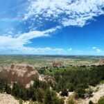
Sage Creek Rim Road (SD 590) is a dirt and gravel road running along the north rim of the Sage Creek Wilderness Area. It connects SD 44 just east of Scenic with the Badlands Loop Road just north of the Pinnacles Overlook, which means you can run it as a loop from either park entrance. Overlooks along the way, going east to west, are Hay Butte, Badlands Wilderness, Roberts Prairie Dog Town, and Sage Creek Basin.
Bison, bighorn, and pronghorn are common, and the prairie dog town is worth the stop. The road is well maintained and any vehicle handles it in dry weather. After rain or snow it turns rutted and slick, and the Park Service closes it when conditions get bad. Check before you commit.
Camping: Sage Creek Campground sits right off the road, and it is free, first come first served, about 22 sites, vault toilets, no water, no campfires. Bison walk through it regularly. Rigs over 18 feet are not allowed, and the 10-day stay limit applies.
Badlands: the free camping outside the park
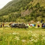
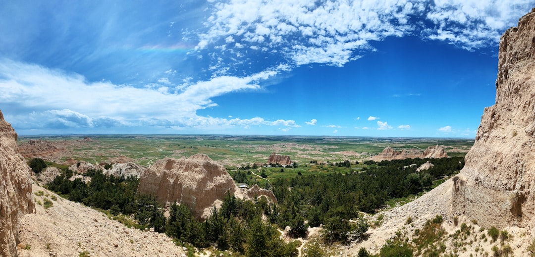
The best-known dispersed camping in the state is on Buffalo Gap National Grassland, on the ridge locals call the Wall or Nomad View, about six miles south of Wall on Highway 240 near the Pinnacles entrance. Access is off Forest System Roads 7158 and 7170, and the Forest Service manages it as the Pinnacles Dispersed Camping Area with roughly 70 sites marked by wooden posts.
Free, no reservations, 14-day stay limit, zero facilities. The view over the formations at sunset is one of the better free camps in the country, and the wind up there is relentless, so stake accordingly. Cattle graze the area between May and September. Skip it entirely if the ground is wet, because those two-track access roads turn to grease and you will damage the road and probably yourself.
Black Hills: the forest road network
This is where most of your actual South Dakota overlanding happens, and it is the part the generic guides never mention.
Beyond the 700-plus miles of designated OHV trail, the Black Hills National Forest carries thousands of miles of forest service roads, the three-digit numbered routes on the MVUM, plus roughly 500 miles of roads marked “open to all vehicles” that connect the trail systems together. These are the routes a full-size rig belongs on. Gravel and dirt, creek crossings, decent camping, and enough network to build multi-day loops between Custer, Hill City, Nemo, and Deadwood.
Difficulty ranges from graded gravel to washed-out two-track depending on the road and the season. Nothing here requires lockers, but ground clearance and decent tires matter, and a few of the gulch roads get rough enough that you will want to air down.
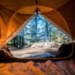
Dispersed camping is allowed off many forest roads, and the MVUM has dispersed camping tables that tell you which ones and how far off the road you can go. One rule that trips people up constantly: campfires are not allowed while dispersed camping on the South Dakota portion of the forest. Plan on a stove. Check current fire restrictions before every trip regardless.
Black Hills: Camp 5 and the 4×4 trails
If you want something harder than forest roads, the Camp 5 Motorized Trailhead between Deadwood and Sturgis is the main event. It is the gateway to over 10 miles of rock-crawling and 4×4 routes, and unlike most of the forest’s OHV network, the Camp 5 trails are not width restricted, so full-size rigs are welcome.
The trails run through creek beds, boulder fields, and up ledges, and difficulty climbs fast. Trails 8042, 8043, 8045, 8046, and 8049 are the extreme ones and are genuinely hard, the kind of thing local 4×4 clubs come for. Trails 8044 and 8047 pass through the same area and are much more manageable, but they intersect the hard lines in several places, so pay attention to markers or you will drift onto something you did not sign up for. Hal Johns, off Boulder Canyon Road, is one of the better known crawling lines in the Hills.
Getting there: I-90 exit 30 in Sturgis, west on SD 34 / Lazelle, which becomes US 14 ALT / Boulder Canyon Road, then about 5.4 miles to Camp 5 Road on the south side. Parking is a hundred yards down on the left.
Realistically, a stock full-size rig with good tires can enjoy the easier lines here and should stay off the extreme ones. Body damage is the normal outcome of guessing wrong. If you want a sense of how we rate difficulty, our Utah trail guide uses the same scale.
Custer State Park: know your dimensions
Custer State Park is 71,000 acres of bison, elk, and pronghorn, and it is a scenic drive rather than an off-road destination. Wildlife Loop Road is the wildlife drive and it is genuinely excellent at dawn. But the two roads people come for, Needles Highway and Iron Mountain Road, need a measuring tape more than a transfer case.
Per South Dakota Game, Fish and Parks, Needles Highway (SD 87) has the Needles Eye Tunnel at 8 feet wide by 9 feet 9 inches high and Iron Creek Tunnel at 8 feet 9 inches by 10 feet 10 inches. Iron Mountain Road (SD 16A) is more forgiving with the Doane Robinson at 12 feet by 11 feet 4 inches, C.C. Gideon at 11 feet 6 inches by 10 feet 9 inches, and Scovel Johnson at 10 feet 9 inches by 11 feet.
If you run a roof top tent, a full rack, or anything tall, measure your actual loaded height before you commit to Needles. Plenty of rigs that fit on paper have left paint in the Needles Eye. A park entrance license is required either way.
Know before you go
- The MVUM is the only map that counts. Free from Forest Service offices or online, and it loads into Avenza for offline use. Anything else is a suggestion.
- Motorized Trail Permit. Required for motor vehicles on designated motorized trails in the South Dakota portion of the forest, and for unlicensed OHVs on roads open to all vehicles. Available online and from local vendors.
- Season. The motorized trail system runs May 15 to December 15, weather permitting. Forest roads vary.
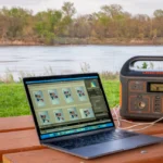
- Cell service is bad to nonexistent across most of this. Download maps and let someone know your route. We keep Starlink Mini in the rig for exactly this kind of country, and the apps we actually use all work offline.
- Weather turns fast. Prairie thunderstorms build in an hour, and every dirt road out here goes from fine to impassable in one of them.
- Confirm with the managing agency. Black Hills National Forest ranger districts for the Hills, the Wall Ranger District for Buffalo Gap, and Badlands National Park for anything inside the park boundary. Closures and fire restrictions change constantly.
Mistakes to avoid
- Planning a route off a blog post instead of the MVUM, including this one
- Assuming a named trail is open to vehicles because it is named
- Taking a full-size rig onto a 62-inch trail and finding out at the first pinch point
- Driving Badlands or grassland dirt when it is wet
- Bringing firewood for a dispersed camp in the SD portion of the Black Hills
- Trusting cell coverage for navigation or for the weather radar
FAQs
A Motorized Vehicle Use Trail Permit is required for motor vehicles on the designated motorized trail system in the South Dakota portion of the forest. Forest roads open to all vehicles are a different category. Confirm your specific route with a ranger district, because the distinction matters and the enforcement is real.
On most of them, no. A large share of the designated trail mileage is limited to vehicles 62 inches wide or less. The Camp 5 area trails are the notable exception, and the forest road network is open to full-size rigs throughout.
Yes on the Black Hills National Forest and on Buffalo Gap National Grassland, with a 14-day limit and no facilities. No dispersed camping inside Badlands National Park. Note the no-campfire rule for dispersed sites on the South Dakota side of the forest.
Late spring through October for most of it. The motorized trail system opens May 15 and closes December 15. Fall is the best combination of weather, color, and thin crowds.
It is one of the better places to start. The forest road network is forgiving, the free camping is easy to find, and you are never that far from a town. If you are still figuring out what you need, start with our camping essentials checklist.
What we’d run if we had four days
Start at the Pinnacles ridge for a night of free camping over the Badlands, run Sage Creek Rim Road west in the morning for the bison and the prairie dog town, then head into the Hills. Two days on the forest road network between Nemo and Deadwood with dispersed camps, one afternoon poking at the easier Camp 5 lines, and a final morning on Iron Mountain Road if the rig fits. That is a legal, unhurried, genuinely good South Dakota week, and none of it requires a trail that bans you.