Last Updated: August 6, 2026
Montana is the best overlanding state most people plan badly. It is huge, the good roads are scattered across a dozen national forests with different travel plans, and a lot of what gets published about it is wrong in ways that matter.
Short answer: the four routes worth planning a Montana trip around are the new Montana Backcountry Discovery Route, the Gravelly Range Road, the Skalkaho Highway, and the Pryor Mountains. Most of Montana’s best driving is high-elevation gravel that opens late and closes early, so June through September is your window. And the food storage rules in grizzly country are legally binding orders, not friendly advice.
Quick reference
| Route | Where | Surface and difficulty | Rig fit | Season |
|---|---|---|---|---|
| Montana BDR (MTBDR) | Island Park ID to Eureka MT | Gravel, forest road, some two-track | Built for moto, most of it works for 4×4 | Summer, snow lingers high |
| Gravelly Range Road (FS 290) | Ennis, Madison Ranger District | Gravel, mostly above 9,000 ft | Full-size friendly | Late June to early fall |
| Skalkaho Highway (MT 38) | Hamilton to Philipsburg | Mostly gravel, narrow, steep | No trailers | Roughly Memorial Day to late November |
| Pryor Mountain Road | Pryor Mountains | Maintained gravel | Passenger cars in dry weather | Summer, dry only |
| Burnt Timber Ridge Road | Pryor Mountains | Rough 4WD | Capable 4×4, see BLM warning below | Summer, dry only |
| Sykes Ridge Road | Pryor Mountains | Hard 4WD, ledges | Experienced drivers, expect damage | Summer, dry only |
Where you can’t drive
The Continental Divide Trail is a National Scenic Trail. It is not an off-road route, no portion of it is an overlanding route, and any guide that tells you otherwise was not written by someone who has been there.
Designated wilderness is closed to all motorized travel, no exceptions and no permits that change that. In Montana that means the Bob Marshall, the Absaroka-Beartooth, the Anaconda-Pintler, and the Selway-Bitterroot, among others. Wilderness boundaries often sit right against roads you are legally on, so know where the line is.
Roadless country generally. Large sections of the Gravelly Range on both sides of FS 290 are roadless, which is exactly why the wildlife corridor there works. Stay on the road.
And as always, the Motor Vehicle Use Map for whichever forest you are in is the document that decides what is open. Not this article, not onX, not a Facebook group.
The Montana BDR, new for 2026
This is the headline. The Montana Backcountry Discovery Route launched February 7, 2026, and it is the 23rd BDR and the final link in the western BDR network. Roughly 900 miles from Island Park, Idaho, north to the Canadian border near Eureka, crossing more than thirteen mountain ranges. Highlights along the way include the Gravelly Range, the Ruby River Valley, Virginia City, Butte, and the East Pioneer, Highland, and Cabinet Mountains. Free GPS tracks and planning resources are on the BDR site.
One thing to understand before you commit a full-size rig. BDRs are designed and scouted for adventure motorcycles. Most of the mileage is scenic gravel and flowing forest road that a truck handles fine, but the route includes optional harder sections aimed at experienced riders, and some stretches are tight, rutted, or hold snow well into summer. Truck-based travelers have run it, but you should check width and conditions section by section rather than assuming the whole thing is 4×4 territory.
Gravelly Range Road
If you drive one road in Montana, make it this one. Forest Service Road 290 runs about 38 miles from the Madison River Valley near Ennis up to Black Butte Cabin, and it spends most of that distance above 9,000 feet, topping out around 9,600 feet on Monument Ridge. Black Butte itself rises to 10,546 feet just southwest.
It is subalpine meadow, conifer, and occasional rocky ravine, with elk, deer, and pronghorn that are skittish because they see so few people. Black Butte Cabin at 8,900 feet is in the Forest Service rental program if you want a roof for a night.
Access from Ennis: south on MT 287 about two miles to the Varney Road, south 9.5 miles to the Call Road junction, then west on the Call Road 6.5 miles to the forest boundary. There are no services once you leave the highway, so start with a full tank. Contact the Madison Ranger District for current conditions, because at that elevation the season is short and the weather does what it wants.
Skalkaho Highway (MT 38)
Fifty-four miles connecting Hamilton in the Bitterroot Valley with MT 1 near Philipsburg, over Skalkaho Pass at 7,258 feet. It is called a highway and it is mostly rough gravel, roughly 20 miles of it climbing from the Hamilton side to the pass.
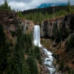
It is narrow, twisting, and short on guardrails and pull-outs, which is why trailers are not advised and in places not allowed. Skalkaho Falls is right off the road and worth the stop. There are no services and no cell coverage between the valleys.
Two small campgrounds sit along the route: Black Bear with 6 sites in the Bitterroot National Forest’s Darby Ranger District, and Crystal Creek with 3 sites in the Beaverhead-Deerlodge’s Pintler Ranger District. Both are first come, first served.
Snow closes the middle of the road from roughly late November until Memorial Day weekend, and it can close mid-summer during storms. Call 511 for Montana road conditions before you commit to the crossing.
Pryor Mountains
The Pryors are the most interesting corner of Montana most overlanders skip. The Pryor Mountains Wild Horse Range covers about 39,650 acres straddling the Montana and Wyoming border near Bighorn Canyon, and it holds roughly 160 wild mustangs, the only wild horse herd in the state.
Three roads get you in, and they are wildly different:
Pryor Mountain Road (also called Sage Creek Road) is maintained gravel and passable by a passenger car in dry weather, bumpy in the last few miles. This is the sane option.
Burnt Timber Ridge Road is a rough 4WD route through the center of the range and gives you the best odds of seeing horses. Note that BLM’s own guidance calls it unmaintained and rough and says even 4×4 vehicles are not recommended due to deteriorating conditions. Trip reports from experienced drivers rate it as manageable, so treat the official warning as a signal that conditions have gotten worse and confirm current status with the BLM Billings Field Office before you go.
Sykes Ridge Road is the hard one. Relentless ledges, real consequences, and a long list of people who have blown a sidewall or wrecked steering components on it. Go up rather than down if you go at all, and do not go alone.
None of these roads are drivable wet or snowy. The Crow Nation controls some access and requires a permit to cross tribal land, so check your route against ownership before you assume a road is open.
Bear country is a legal requirement, not a vibe
This is the part of Montana overlanding that people from other states get wrong, and it carries actual penalties.
Most Montana national forests operate under food and attractant storage orders. Custer Gallatin, Lolo, Bitterroot, Beaverhead-Deerlodge, and Helena-Lewis and Clark all have them, with district-level exceptions. The Custer Gallatin order runs March 1 through December 1 annually and covers the Beartooth, Bozeman, Gardiner, Hebgen Lake, and Yellowstone Ranger Districts, including the Pryor Mountain Range.
What counts as legal storage:
- An IGBC-certified bear-resistant container or approved product
- Hung at least 10 feet off the ground and 4 feet out from adjacent trees or poles
- A closed hard-sided vehicle or trailer with the windows shut
That last one is the overlander’s advantage. Your rig, buttoned up, is compliant storage. That is a real practical reason vehicle-based travel works well here.
What “unattended” means: in daylight, attended means someone within 100 feet with direct line of sight. At night, attractants must be either properly stored or attended by someone who is awake. Attractants means more than food, it covers trash, cooking gear, toiletries, and anything else that smells like something.
Violations can bring a citation and civil liability for damages. Carry bear spray on your body where you can reach it in seconds, not in the console. Check the current order for the specific forest you are entering, since the districts and dates change.
Dispersed camping
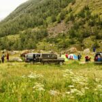
Dispersed camping is generally allowed on Montana national forest and BLM land within the rules of the local travel plan, typically with a 14-day limit and a requirement to camp within a set distance of a designated road. The specifics change by forest, so the MVUM and the district office are your sources.
Fire restrictions in Montana get serious fast in late summer, and they change week to week. Check before every trip and plan to cook on a stove. What to bring is covered in our overlanding packing list.
Know before you go
- Season is short. High routes hold snow into July some years and can close by October. June through September is the reliable window.
- Download everything. Cell coverage disappears fast out here. The apps we use all work offline, and for genuinely remote stretches we run Starlink Mini.
- Call 511 for Montana road conditions, and call the relevant ranger district for anything on forest roads.
- Fuel range matters more than in most states. Distances between services on these routes are long enough to plan around.
- Glacier National Park has vehicle size restrictions on Going-to-the-Sun Road and a seasonal vehicle reservation system. If Glacier is on your route, confirm current requirements before you arrive.
Mistakes to avoid
- Planning around a trail that turns out to be non-motorized
- Assuming a BDR track means a truck-friendly track for its whole length
- Driving Pryor Mountains roads on a wet forecast
- Treating food storage orders as suggestions
- Counting on a high pass being open in early June
- Skipping the MVUM because a mapping app showed a road
FAQs
There is no statewide overlanding permit, but that does not mean the rules are loose. Travel is restricted to designated routes per each forest’s MVUM, wilderness is closed to vehicles, food storage orders apply in bear country, and some access crosses tribal land that requires permission. Check locally rather than assuming.
Much of it, yes. It was scouted for adventure motorcycles, and the optional expert sections and some tighter stretches are not the place for a wide rig. Check conditions stage by stage.
Most high-elevation gravel is reliable from late June through September. Skalkaho typically opens around Memorial Day weekend and closes in late November, and the Gravelly Range is even shorter at the top.
Yes, and on your body rather than in the vehicle. Montana is grizzly country across most of the western half of the state, and the food storage rules exist because the encounters are real.
Pick one region. The Pryors from Billings, or Skalkaho and the Sapphires from Hamilton, are both doable in two or three days. Montana punishes people who try to see it all in one trip.
Pick a range and go deep
Montana is not a state you check off. It is four or five separate trips wearing one name, and the people who come back happy are the ones who picked a single mountain range and spent three days there instead of driving 900 miles of gravel to say they did. Start with the Gravelly Range or the Pryors, get the food storage habits down, and let the state give you a reason to come back. If you want a shorter drive from the Midwest to warm up on, the South Dakota routes are a good first weekend.