Last Updated: August 6, 2026
Idaho has more roadless country than any state outside Alaska, and that fact cuts both ways for overlanders. The scenery is unmatched, and a huge share of what looks drivable on a map is designated wilderness where no motor vehicle has been legal since 1980.
Short answer: the three Idaho routes worth building a trip around are the Magruder Corridor, the Owyhee Uplands Backcountry Byway, and the Idaho Backcountry Discovery Route. The Magruder is the crown jewel, 101 miles of single-lane dirt threading between the two largest wilderness areas in the lower 48. Season is short, services are nonexistent, and you should assume no cell coverage anywhere on this list.
Quick reference
| Route | Where | Length | Difficulty | Season |
|---|---|---|---|---|
| Magruder Corridor (FR 468) | Red River, ID to Darby, MT | 101 miles | High clearance, 4WD recommended | Mid-July to late October |
| Owyhee Uplands Backcountry Byway | Grand View, ID to Jordan Valley, OR | 103 miles | Graded gravel, easy when dry | Late spring and early fall |
| Doublespring Pass Road (FR 116) | Mackay to the Pahsimeroi Valley | ~50 miles as a loop | Gravel and rough dirt, high clearance | Summer into early fall |
| Idaho BDR (IDBDR) | Jarbidge, NV to the Canadian border | ~1,250 miles, 8 sections | Mostly moderate, some technical | Summer into early fall |
Where you can’t drive
This is the part the old version got wrong, and it is the single most important thing to understand about Idaho.
The Frank Church-River of No Return Wilderness is 2.3 million acres, the largest wilderness area in the lower 48, and it is closed to all motorized and mechanized travel. No trucks, no ATVs, no mountain bikes. There is no Middle Fork Salmon River Road. Access is by foot, horse, raft, or backcountry airstrip.
The Selway-Bitterroot Wilderness is another 1.2 million acres under the same rules, directly north.
Here is how absolute that is: the Idaho Backcountry Discovery Route, a route designed specifically to find the best legal dirt in the state, cannot get past these two wildernesses. It detours east through the Magruder Corridor into Darby, Montana, runs north on US 93, and re-enters Idaho south of Missoula. Nearly a hundred miles of pavement in a backcountry route, because there is genuinely no way through.
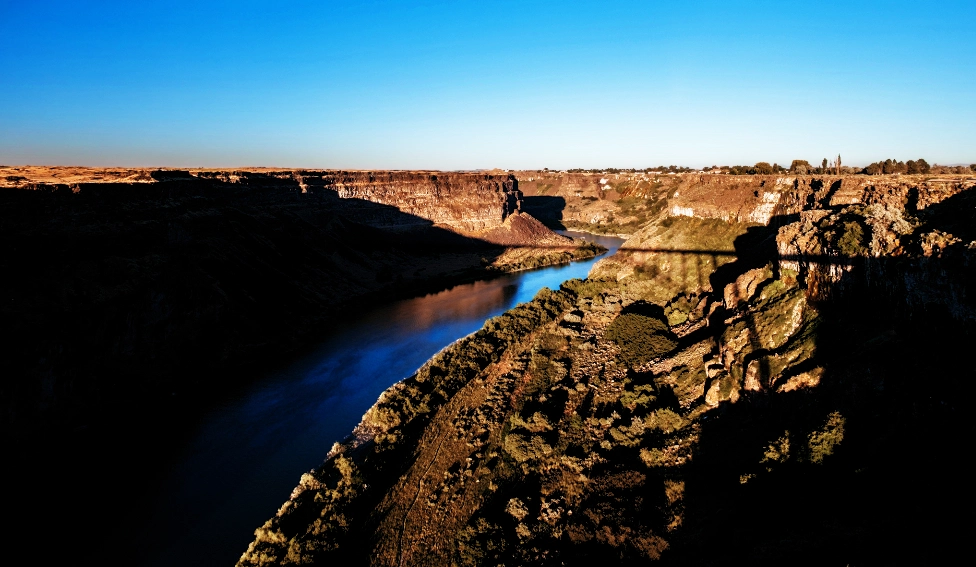
The Owyhee Canyonlands hold roughly 517,000 acres of designated wilderness and wilderness study areas. Off-highway vehicle travel is prohibited in them. The byway and the primitive roads off it are legal, the wilderness they access is not.
Fisher Creek near Stanley is a famous mountain bike loop, not a 4×4 route. And the Sawtooth Scenic Byway is a paved state highway. Both are worth doing, neither is overlanding.
The Magruder Corridor
If you drive one road in Idaho, this is it.
Forest Road 468 runs 101 miles of single-lane, mostly unimproved dirt from the old Red River Ranger Station to Darby, Montana. The Civilian Conservation Corps built it in the 1930s and it has changed remarkably little since. The corridor itself was created in 1980, when the wilderness designations went in around it, leaving one thin ribbon of legal road between 1.2 million acres of Selway-Bitterroot to the north and 2.3 million acres of Frank Church to the south.
The Forest Service estimates six to eight hours from Red River to Darby with no stops, at an average of 12 to 15 miles per hour. That number tells you everything about the road. Plan two days and camp along the way at one of the dispersed or primitive sites.
It is named for Lloyd Magruder, an Elk City merchant murdered on the route in 1863 near mile 44.2 westbound. His killers were caught, tried in Lewiston, and hanged in the first legal execution in Idaho Territory.
What you need: high clearance, and 4WD is strongly recommended. The Forest Service specifically advises against low-clearance vehicles, motor homes, and anything towing. Full-size spare, recovery gear, and fuel for the whole run, because there is none between Elk City and Darby.
Getting there: from Grangeville, take State Highway 14 toward Elk City, then turn right on Red River Road 222 toward the old Red River Ranger Station, about 65 miles east of Grangeville. The west end of FR 468 meets Road 222 about a third of a mile south of the station. The east end sits just south of the West Fork Ranger Station, roughly 18 miles southwest of Darby.
Season: typically opens mid-July after snowmelt and closes with the first real snow, often late October. August through mid-September is the reliable window.
Camping and rules: dispersed camping is allowed along the corridor. Paradise Guard Station is a rentable cabin if you plan ahead. Camp 200 feet from trails and water, use existing fire rings, and note that all forage and mulch on national forest land in Idaho and Montana must be certified weed-seed-free. And the obvious one that people still get wrong: stay on the road. Wilderness starts at the edge of it on both sides.
The Magruder drops you in Darby, which puts you at the doorstep of the Skalkaho Highway and the rest of our Montana routes if you want to keep going.
Owyhee Uplands Backcountry Byway
Completely different Idaho. This is the high desert southwest corner, and it is one of the emptiest places in the state.
The byway is 103 miles of graded gravel running from Grand View, Idaho to Jordan Valley, Oregon, about 91 miles of it in Idaho. Locals call it the Mud Flat Road, which is a warning label as much as a name. It is mostly one to one-and-a-half lanes through gentle rolling terrain, with grades up to about 12 percent in places.
Sagebrush and old-growth juniper give way to red-walled river canyons. It is habitat for sage grouse, redband trout, and pronghorn, and it is quiet in a way that surprises people used to busier public land.
Difficulty: honestly easy in dry conditions. BLM says most passenger vehicles handle it fine. Wet is a different story, the road is notoriously slick, and it is usually impassable November through April.
Services: none. Limited fuel and supplies at Grand View and Jordan Valley on either end and nothing in between, no cell coverage, and one developed site along the whole route, the North Fork Recreation Site with picnic tables, fire rings, and vault toilets. Dispersed camping is otherwise the plan.
Worth the detour: Silver City, one of Idaho’s best-preserved ghost towns, is accessible seasonally off the eastern end. And if someone told you the Owyhee has sand dunes, they were thinking of Bruneau Dunes State Park, which is a separate place east of Grand View and worth a stop on its own.
Timing: late spring and early fall. Summer heat out here is punishing and there is no shade to speak of.
Lost River Range
Idaho’s highest country, and one of the few places in the state where the best scenery sits outside a wilderness boundary. The Lost River Range runs about 75 miles southeast from the Salmon River near Challis down to the Snake River plain near Arco, and it holds Borah Peak at 12,662 feet along with most of Idaho’s other 12,000-foot summits: Leatherman, Breitenbach, Donaldson, Church, Lost River Mountain.
This is Salmon-Challis National Forest and BLM country, not designated wilderness, so vehicle travel on designated roads is legal here in a way it simply is not in the Frank Church. That is the whole reason this range belongs on the list.
The range only has two crossings. Double Springs Pass in the north and Pass Creek in the south. That is it for 75 miles of mountains, which tells you something about the terrain.
Doublespring Pass Road is the one to drive. From Mackay, head north on US 93 for about 22 miles to the Mount Borah historical marker and turn right onto Doublesprings Road, also signed as Route 116. Two and a half miles in you reach the Mount Borah Earthquake Interpretive Site.
Stop there. On October 28, 1983, the Borah Peak earthquake ruptured the Lost River Fault, dropped the Big Lost River Valley, lifted the range, and left a fault scarp up to 14 feet high that you can still trace for more than 20 miles along the base of the mountains. Borah itself rose roughly seven feet. It is one of the most legible earthquake scarps in North America and you can walk up and put your hand on it.
From the interpretive site the road climbs over Double Springs Pass and drops into the Pahsimeroi Valley, with Borah, Leatherman, and Breitenbach standing over you the whole way. From the valley you can take Forest Road 118 along the East Fork of the Pahsimeroi or Route 267 along the West Fork, both of which loop you back toward US 93. It makes a solid full day out of Mackay.
A real warning about the east side. The western flank of the range is easy to reach off US 93. The eastern approaches are not. Access roads on the Pahsimeroi side are some of the roughest in Idaho, high-clearance 4WD is a genuine requirement rather than a suggestion, and there are no services on the Pahsimeroi side at all and very few on the Big Lost side. Carry more fuel and more than one spare.
Camping: there are no developed campgrounds in the range itself. Joe T. Fallini Campground on Mackay Reservoir is the developed option and the views of Mount McCaleb from there are worth the stay. Primitive sites exist at the Borah trailhead, which is three gravel miles up Birch Springs Road just past milepost 129, with a vault toilet and a handful of basic sites, and there is dispersed camping in the East Fork of the Pahsimeroi.
While you are there: Mackay sits on the Peaks to Craters Scenic Byway, and the town’s self-guided Mine Hill driving tour covers its copper mining history on a genuinely scenic set of roads above town. Note: The Mine Hill tour is not passable for motorhomes, trailers or street motorcycles and their may be temporary trail closures due to mining operations.
Season: high country here holds snow late. Summer into early fall is the window, and afternoon storms at elevation are the norm rather than the exception.
The Idaho Backcountry Discovery Route
The IDBDR was BDR’s fifth route and it is one of the longest in the system, roughly 1,250 miles in eight sections from Jarbidge, Nevada to the Canadian border at the Idaho Panhandle. Free GPS tracks are on the BDR site.
It runs through the Boise National Forest past Anderson Reservoir, up to alpine camping at Trinity Lakes, through small towns like Yellow Pine, Elk City, Avery, and Wallace, past Burgdorf Hot Springs, and takes in both the Magruder Corridor and the Lolo Motorway before finishing through Sandpoint and Bonners Ferry.
Two things to know before you plan around it. First, it is a motorcycle route by design, scouted for dual-sport and adventure bikes, so full-size rigs should check width and conditions section by section rather than assuming the whole thing works. Second, at 1,250 miles it is not a week-long trip unless you are blasting through eight to ten hours a day. Most people take it in sections, and sections are the right way to use it: pick two or three, do them properly, come back for the rest.
Permits, stickers, and staying legal
Idaho does not have a blanket overlanding permit, but that is not the same as no rules.
- The Motor Vehicle Use Map for whichever national forest you are in decides what is open to what. It is free, it loads into Avenza for offline use, and it is the only map that matters legally.
- Idaho OHV registration and sticker requirements apply to off-highway vehicles. A street-legal, licensed full-size vehicle on a forest road is generally a different category, but if you are running an unlicensed rig or a UTV, check before you go.
- Wilderness boundaries frequently sit right against legal roads. Know where the line is, especially on the Magruder and off the Owyhee byway.
- Fire restrictions change week to week in late summer. Check before every trip.
Camping
Dispersed camping is broadly allowed on Idaho national forest and BLM land, generally with a 14-day limit and rules about distance from roads and water that vary by district. Camp 200 feet from water and trails as a default, use existing fire rings, and pack everything out.
What to bring is covered in the overlanding packing list. For Idaho specifically, carry more fuel and more water than you think, because the gaps between services on these three routes are the longest on any route we cover.
Know before you go
- Season is short in the north. The Magruder and most high-elevation Idaho dirt is a mid-July through October proposition. The Owyhee is the opposite, best in spring and fall and miserable in midsummer heat.
- No cell coverage. Assume none, anywhere, on all three routes. Download offline maps. The apps we use work without signal, and for genuinely remote stretches we run Starlink Mini.
- Fuel range is the real constraint. The Magruder alone will take four to five gallons in an efficient truck with no station for 101 miles.
- Idaho has two time zones. The northern part of the state runs on Pacific time, the south on Mountain. It catches people out on long north-south routes.
- Call the ranger district. Nez Perce-Clearwater and Bitterroot for the Magruder, Boise BLM for the Owyhee. Conditions change and they will tell you.
Mistakes to avoid
- Planning any part of a trip inside the Frank Church or Selway-Bitterroot
- Treating a mountain bike loop or a paved scenic byway as an overland route
- Running the Owyhee byway on a wet forecast
- Underestimating the Magruder’s 12 to 15 mph average and trying it in a day
- Starting the Magruder without a full tank and a full-size spare
- Assuming an IDBDR track is truck-width for its whole length
FAQs
No. It is designated wilderness, closed to all motorized and mechanized travel. The Magruder Corridor runs along its northern boundary and is the closest legal thing, which is exactly what makes that road special.
Not technical, but committing. Single-lane dirt with steep grades, drop-offs, and washboard, at an average of 12 to 15 miles per hour for 101 miles with no services. High clearance is required and 4WD is strongly recommended.
Usually mid-July after the snow clears, closing with the first significant snowfall in late October. Check with the ranger district, because the dates move every year.
No general permit, but travel is restricted to designated routes per each forest’s MVUM, wilderness is closed to vehicles, and OHV registration rules apply to unlicensed vehicles. Check locally.
The Owyhee Uplands Backcountry Byway. It is legal, well-signed, doable in a day from Boise, and forgiving in dry weather, which makes it a good place to learn what remote actually feels like before you commit to the Magruder.
Pick the corridor, not the wilderness
The thing that makes Idaho great for overlanding is the same thing that limits it. All that protected country is why the drives that do exist feel like nothing else in the lower 48, and why a single-lane dirt road built by the CCC in the 1930s is still the best route in the state. You are not going to see Idaho’s backcountry from behind the wheel. You are going to drive the thin legal line along the edge of it, camp there, and walk in from the road. That is the trip. If you want a shorter shakedown first, the South Dakota routes are a good weekend.